Playa del Risco (Lanzarote): how to get there, route along the Path of the Gracioseros and local advice
Under the Risco beach is one of those jewels of Lanzarote that you will remember for the rest of your life. Getting there is part of the plan: a zigzagging path, wind that sometimes gets tight and a spectacular landscape that reconciles you with the island. If you prepare the access well, choose the day with reasonable wind/tide and take enough water, the experience is a great one. I will continue to go down several times a year: it is my favourite way to disconnect and enjoy this marvellous corner of the island.
Why Beach Under the Cliff is so enchanting
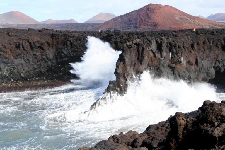
When I want to reset, I go down to Playa del Risco. I live in Famara and I go there several times a year; sometimes alone, sometimes with my partner or with friends. What gets me hooked is that feeling of freedom when I look out from the Mirador del Río and then step onto an unspoilt beach at the foot of the cliff. There are no beach bars or deckchairs here: just golden sand, clear waters and the breathtaking views of La Graciosa and the Chinijo Archipelago.
Be careful: precisely because it is so wild, planning is key.
What you’ll find (and what you won’t)
- Yes: tranquility, spectacular scenery, “wow” sensations, clean water, some moderate swell depending on the day.
- No: toilets (toilets, showers, bars), lifeguard, no litter bins. Bring everything and take everything with you( zerorubbish ). You won’t find one of the most beautiful beaches in Lanzarote either, when it blows hard it can be very annoying especially in the summer months.
Location: where is the beach behind the Risco in Lanzarote?
Risco beach (also Playa Bajo el Risco, Playa detrás del Risco or Playa de Bajo Risco) is at the foot of the Famara cliff, just in front of the Estrecho de El Río, with La Graciosa as a backdrop. It feels isolated, but as the crow flies you are close to Haría, Yé, Mirador del Río and, looking in the distance, Famara.
To get a mental picture of where you are: imagine the wall of the Risco de Famara falling into the sea; at its base is this long beach. At high tide, the tongue of sand narrows; at low tide you gain metres for a stroll.
If you are wondering if you can surf on this beach, the answer is that it is not a classic surf spot. The orientation and the shelter of the Risco mean that, although there are sometimes moderate waves, it is not the best option.
If you are looking for surfing in Lanzarote, go to Famara (my playground), with peaks for different levels and surf schools if you are just starting out.
At Playa bajo Risco focus on swimming with caution, snorkelling on very calm days and enjoying the surroundings.
How to get there from Yé / Mirador del Rio
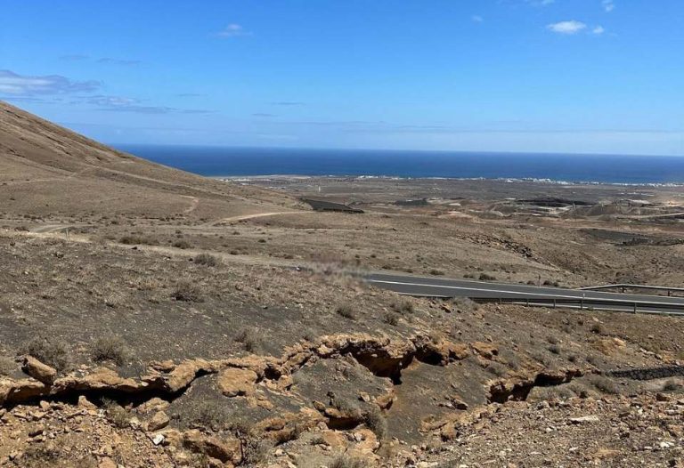
The most iconic option is on foot along the Camino de los Gracioseros. It’s the one I usually use because it combines spectacular views with an affordable hike if you’re prepared. The Mirador de Yé or Mirador del Río is the start and return point of this iconic trail.

Route to Playa del Risco (Los Gracioseros path): duration and difficulty
- Type: Historic zigzagging path that descends the Risco.
- Duration: 40-60 min downhill and a bit more uphill (depending on fitness and photo stops).
- Difficulty: moderate. It is not technical, but there is loose gravel in some sections and the return trip is very tiring.
- Footwear: closed shoes with grippy soles. Avoid flip-flops for the descent.
- Mobile coverage: can be patchy. Be aware of this if you are on your own.
I usually start early in the morning; the shade of the cliffs helps in summer. The worst days for me are windy days: the trade winds can make the climb heavy and the sand is quite annoying.
Descent to Risco beach: what to expect
The descent is a constant zigzag. Take it easy, watch your step and don’t be overconfident on the way back: the ascent is always more demanding. If you go with children, make sure they are used to walking; with dogs, respect the rules and think about the heat of the ground.
Access and parking (location and starting point)
The location of the classic start is between Yé and the Mirador del Río. The usual is:
- Reach Yé (road to the Mirador).
- Look for the start of the signposted path to Playa del Risco / Camino de los Gracioseros.
- Park sensibly: there are informal spaces next to farm tracks. Do not block entrances to farms or occupy narrow verges.
If it is not clear, park in designated areas around the viewpoint and walk a few minutes to the start of the path.
Equipment and logistics: getting water, what to bring and safety
There’s nothing here, and that’s part of the charm. But you have to be prepared.
Getting food and water
- Water: carry at least 1.5-2 L per person (more in summer). There are no fountains or kiosks.
- Food: sandwich, fruit, nuts. Avoid flying containers if the wind blows.
- Last purchase: do it in Haría, Yé or Órzola before you go.
If you are wondering where to get water: the answer is bring your own.
Backpack and equipment recommended
- Shoes with grippy soles, comfortable clothes (I always go down like this).
- Cap, goggles, high cream, light wind cut.
- Towel, bag for your rubbish, basic first aid kit (plasters, sticking plaster).
- Weather and tide app to choose the day (wind + tide greatly influence the experience).
Security and common sense
- Avoid central hours in summer if you are not used to it.
- If it blows hard, consider changing your plan: the wind at the Risco can be uncomfortable and can kick up sand.
- Control tides if you want a wide beach.
- Remember that the final climb is what “burns” the most. Save water and energy.

Best time to go
The morning shade from the cliff helps in summer; the trade wind (NE) blows stronger in summer and tends to be lighter in winter-autumn. Use it to choose time zone and day.
STATION | PREVAILING WIND | WHAT TO EXPECT ON THE CLIFF | RECOMMENDED TIDE | SUGGESTED TIME SLOT | PRACTICAL ADVICE |
|---|---|---|---|---|---|
Winter (Dec-Feb) | NE (milder trade winds) | Calmer days; cooler breezes | Medium-low to gain metres of sand | Mornings (partial shade) | Ideal for long walks; water and light windbreaker |
Spring (Mar-May) | NE increasing | Alternating mild days with spells | Medium (avoid high tide if you want a wide beach) | Tomorrow | Good compromise climate + light |
Summer (Jun-Sep) | Strong NE ( peaks July-Aug) | Flying sand and demanding climb | Low (best for strolling and lying down) | First hour (shadow of the cliff) | If it blows hard, change the day or the plan. |
Autumn (Oct-Nov) | NE moderate to light | It tends to be more stable and pleasant | Medium-low | Morning or afternoon | Very good time for photos and hiking |
Frequently asked questions to ask yourself if you want to go
About the author

Maike Famara
Director of Surf Famara. A free surfer from the 1970s, renowned in the Canary Islands, he has surfed on five continents (the entire South African coast, Western Australia, Indonesia, Peru, Chile, Puerto Rico, Panama, France, Portugal, Senegal, Morocco...) and has dedicated himself to teaching and developing new surfers since 1996! You can find him in San Juan or La Santa, where he remains connected to the ocean like the first day.